Bears Ears Trip 2025
I’m writing this as of April 2026, but it’s about a trip to Bears Ears National Monument that I took in May of 2025. At the time, my blog was broken so I couldn’t share any photos. But it’s fixed, so here you go.
The general gist of the trip was to spend a few days in and around Bears Ears, in part to do some volunteer work. I’m a Visit With Respect Ambassador for the Bears Ears Partnership. There are a couple hundred of us now, so I read. The basic job is to help the BLM (mainly) and Forest Service (to a smaller degree) keep an eye on the trails in the national monument. We have a list of the highest use trails and we try to visit them as often as possible to make sure the trail is in OK shape, report any vandalism or other weirdness, and engage with the public to answer questions and share information on how to “visit with respect”.
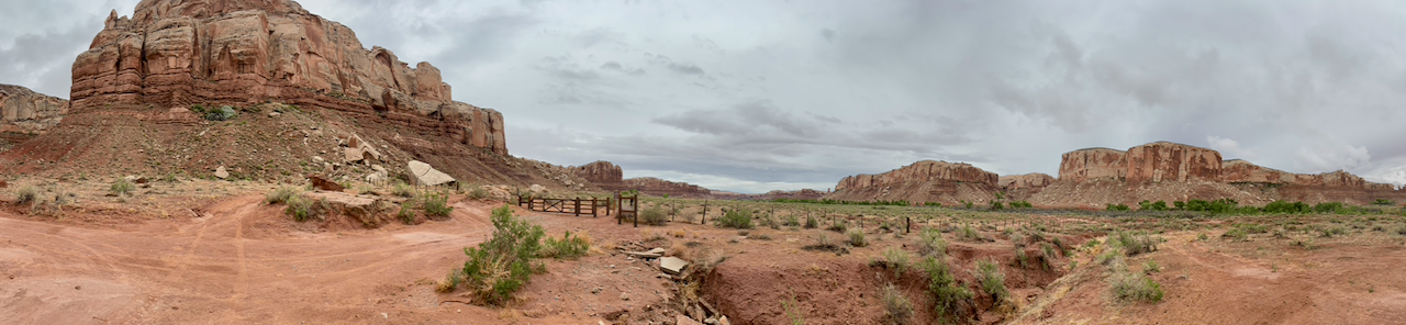
Montezuma Canyon
On this trip, I wanted to visit Montezuma Canyon, so I drove it from north to south on my way ultimately to the Sand Island Campground, where I stayed the week. I’ve never been in this canyon, but archaeologists say that based on the the remains of villages found there, this was the most highest populated area in Utah a thousand years ago.
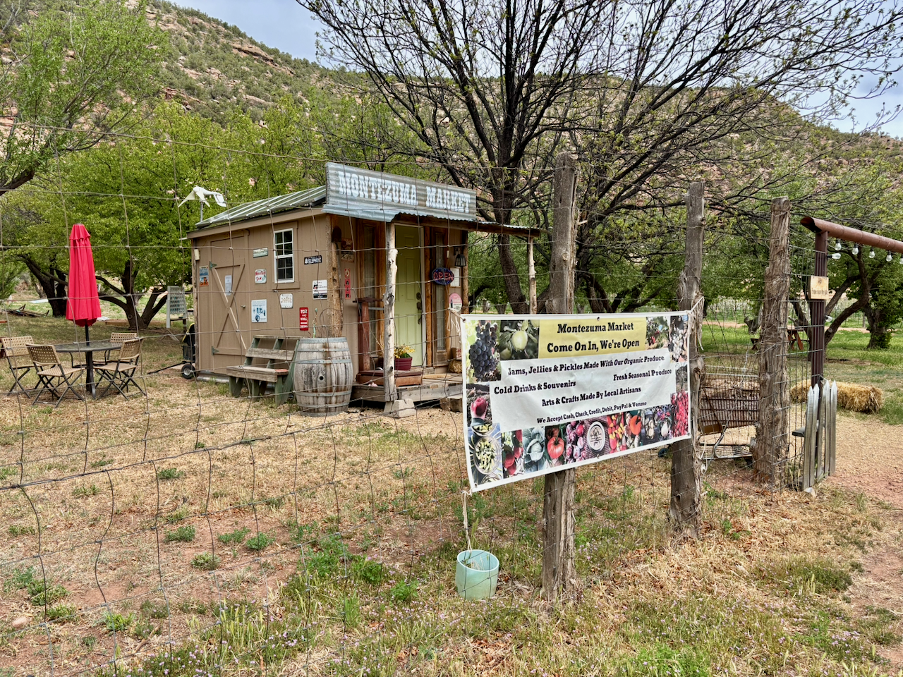
One of the first delightful surprises I ran into was the Montezuma Market. It’s a little building not much larger than a shed where the people who live on this farm sell some of their produce, baked goods, etc. Of course I had to stop.
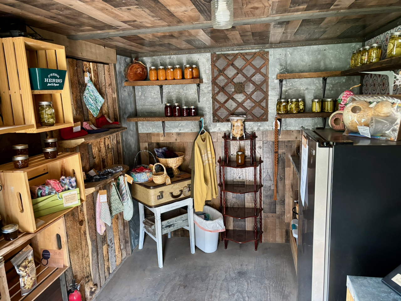
Here’s what it looked like inside. Nobody was there. The whole thing works on the honor system. You add up what you owe and then write it down on a register and leave your money in a little box. They even have a credit card machine, which requires turning on wifi access to the shed. I didn’t want to bother with that, so I just paid cash.
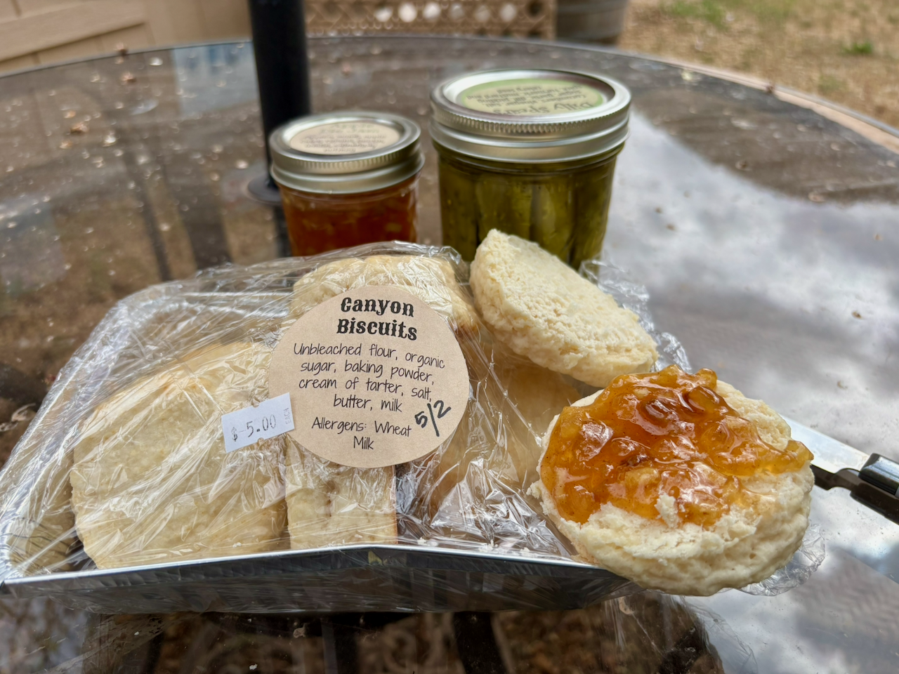
I could not wait, so I used a nearby picnic table to sample the biscuits and homemade jam that I just bought.
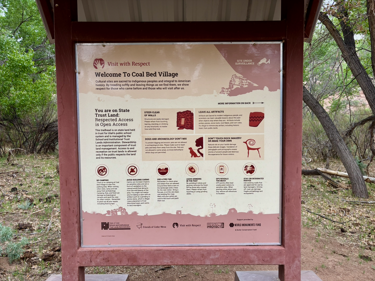
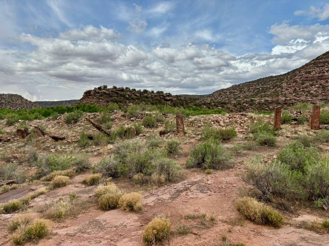
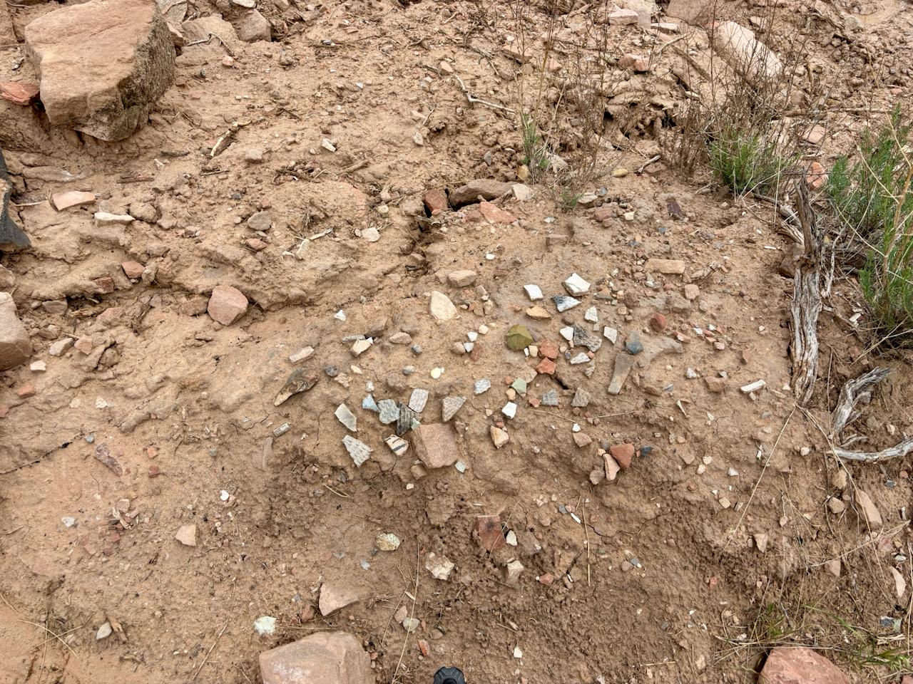
Farther down the canyon, I stopped at Coal Bed Village, which I think was the largest village in Utah at the time. Sadly, much of the village is now eroding into the creek, so archaeologists and students have rushed to do as much research as they can before it’s all destroyed.
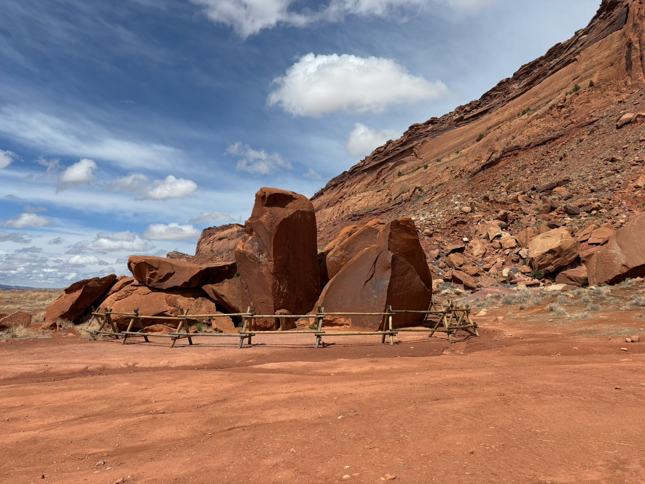
One odd thing I saw there was this circle of standing stones. I have no idea if they think that’s how those stones were a thousand years ago, or if someone put them upright since then.
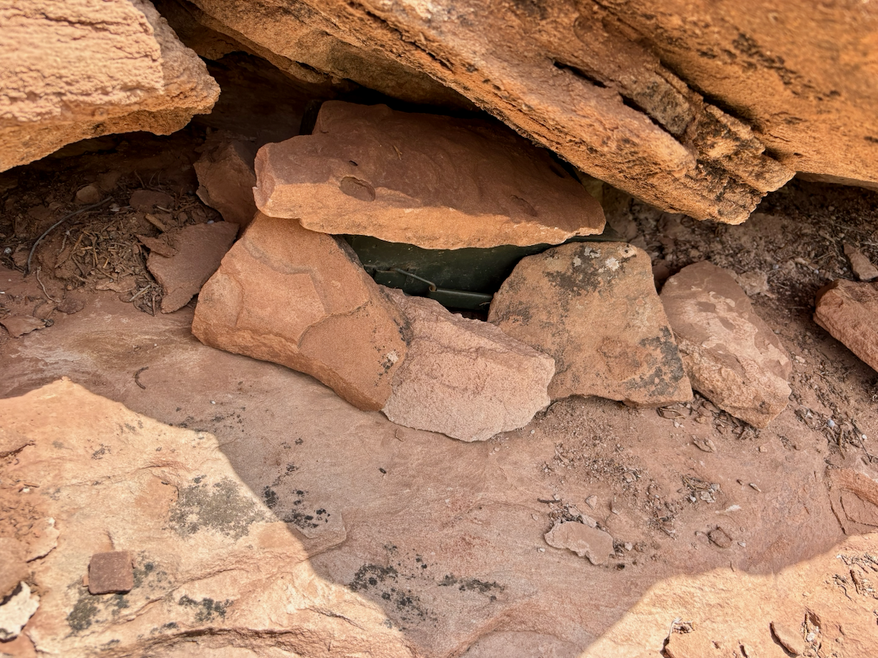
Farther still down the canyon, I decided to do a little geocaching, and went on a short hike up a creekbed to eventually find this hidden ammo can.
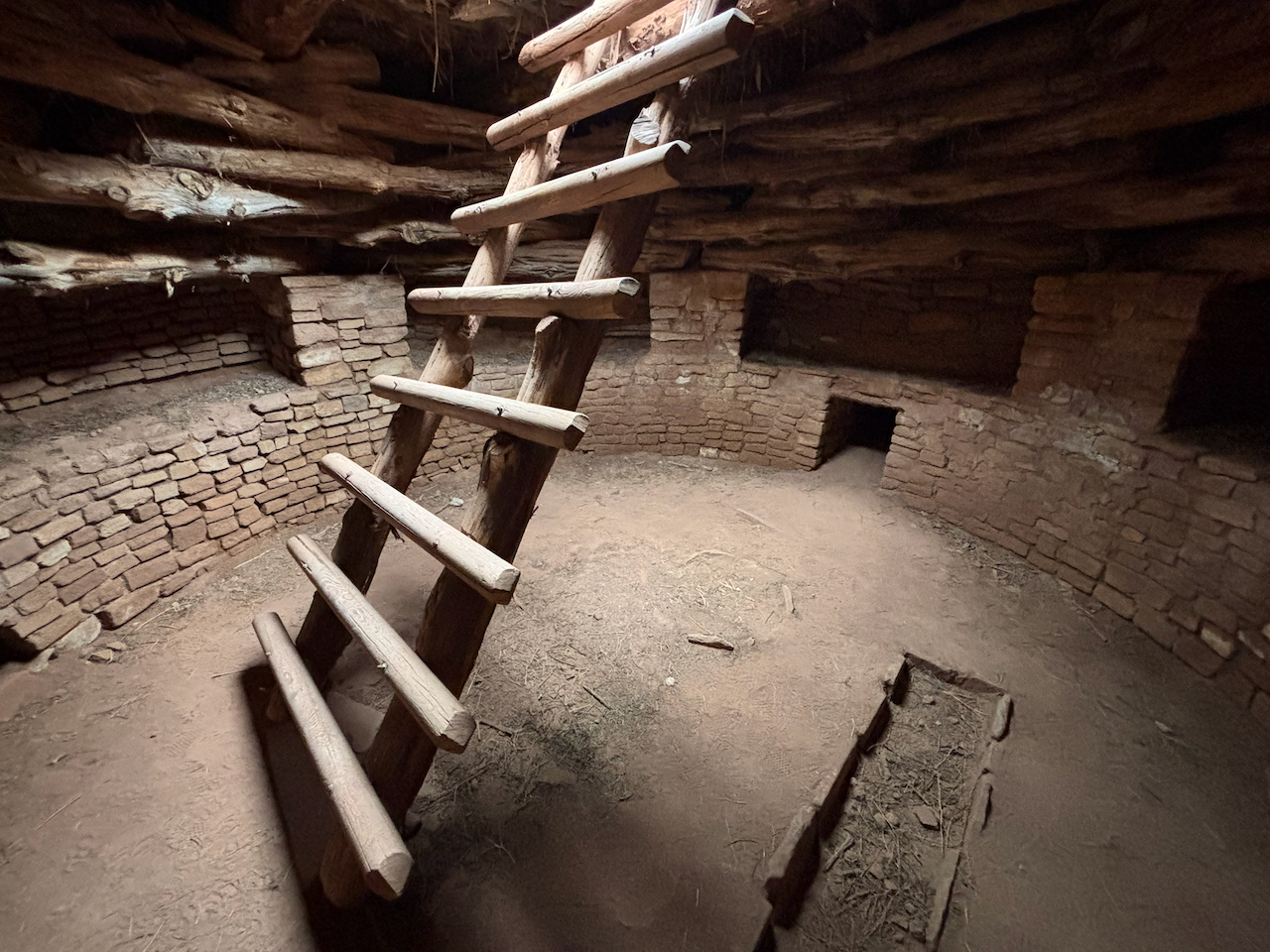
A few more miles down the canyon, there’s another BLM site called Three Kivas. One of the kivas has been restored enough you can climb a ladder into it to get a sense of what it was like. Of course, it’s totally undecorated, unpainted, etc. so it would’ve looked a lot better back when it was in use.
Hovenweep
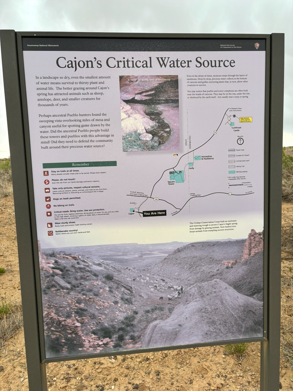
Much of what I did day-to-day on this trip was determined by the weather, because there was rain most days. After settling into my campsite, the next day I didn’t want to go on a long hike because the forecast called for rain. So I decided to drive back east a ways to a small remote section of Hovenweep National Monument that I’d never seen. This is called the Cajon Group.
Camping
I’ve stayed in the Sand Island Campground many times over the past 25 years. It’s a nice upgrade from “dispersed camping” because you get a picnic table, clean water to refill your water bottles from, and a pit toilet. I’m willing to pay money for those conveniences.
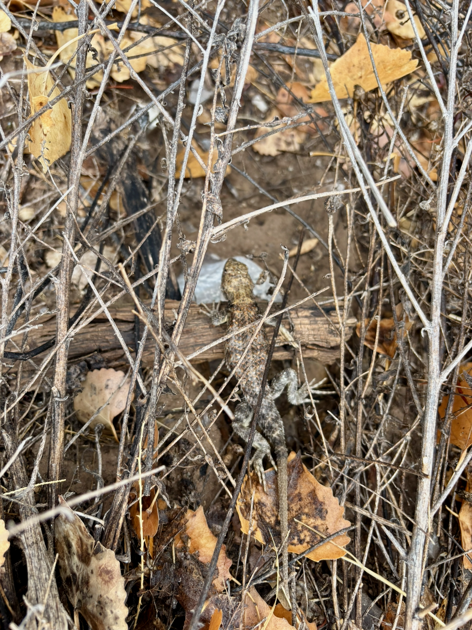
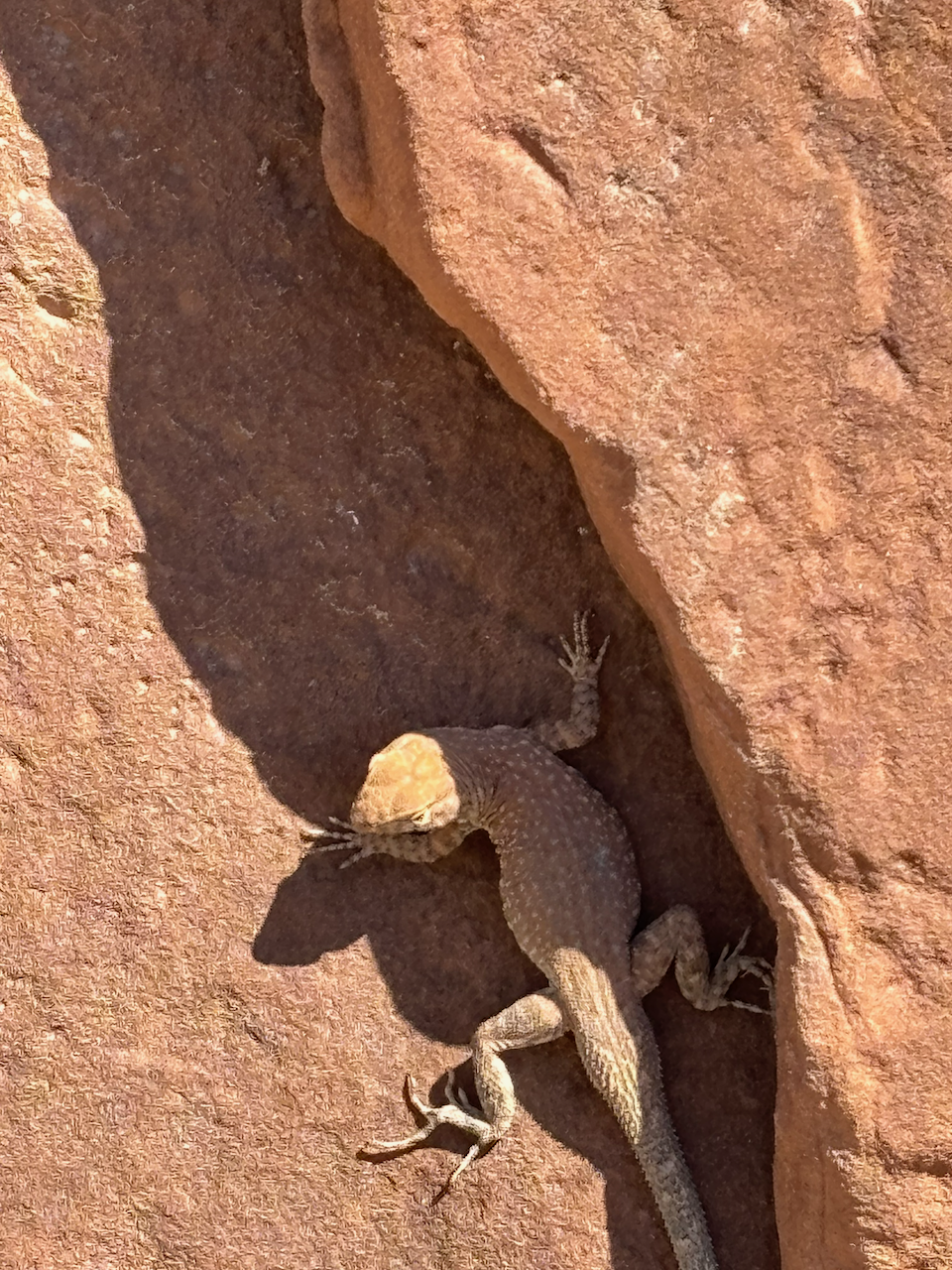
Here’s a lizard friend I found also lived in my campsite.
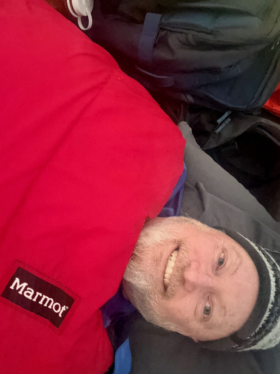
The rain made for very cool nights, and the sun went down early. Since fires weren’t allowed, it meant after supper the coziest place around was in my sleeping back where I’d read for an hour or so before bedtime.
The next day
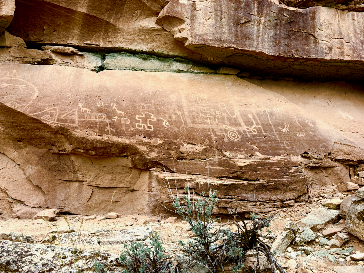
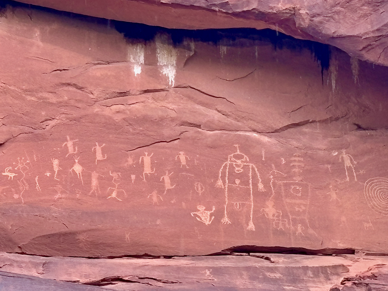
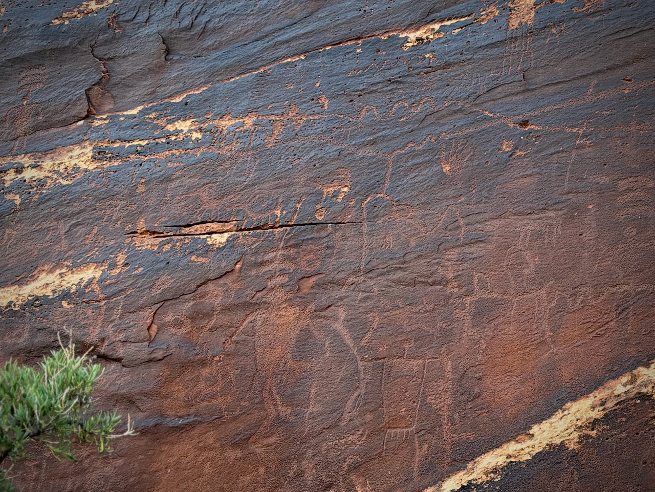
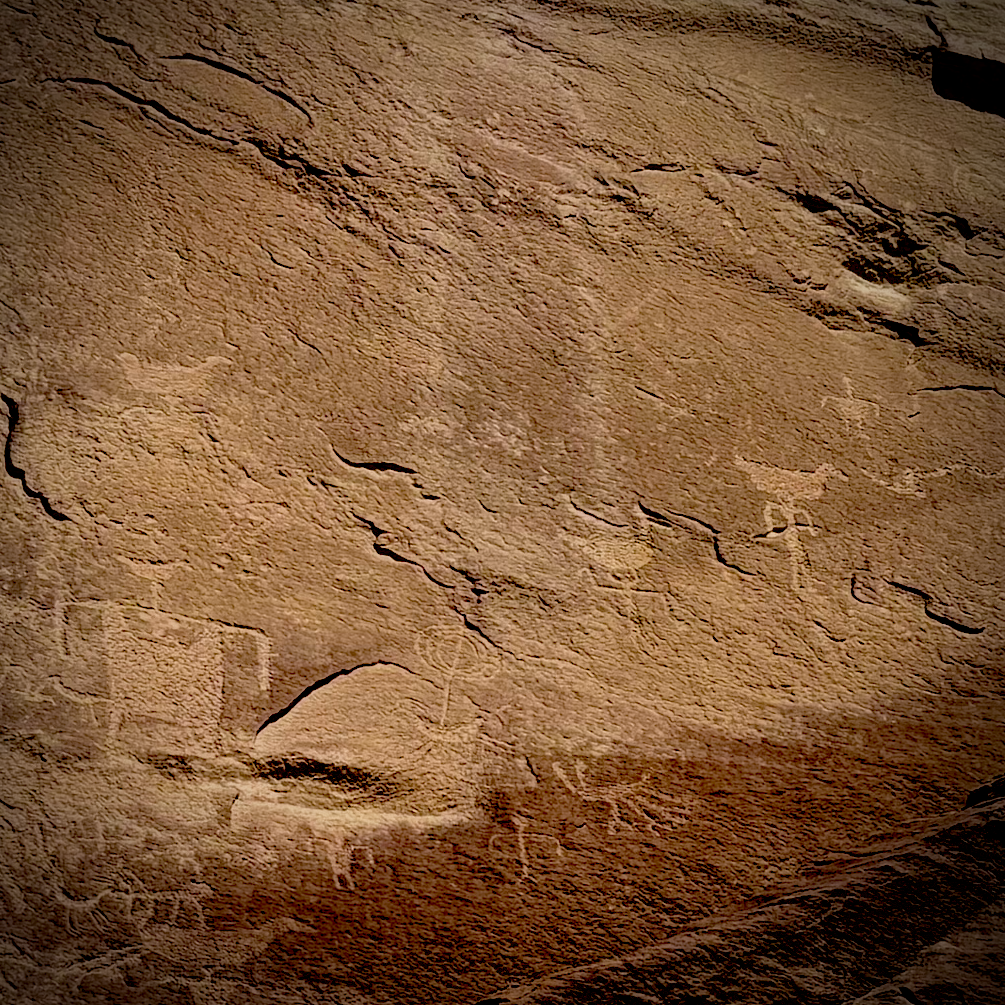
The next morning I went on a little walk to some nearby rock images. I’ve seen them before but it was decades ago. Recently, the Bears Ears Partnership built an ADA compliant path so people in wheelchairs can see most of the petroglyphs. One benefit of the path is it’s crushed gravel, so it meant not having to hike through sloppy mud.
The two boxy people (“anthropomorphs” in rock image lingo) on the right half of the photo are very typical of this region. The style is called Western Basketmaker II.
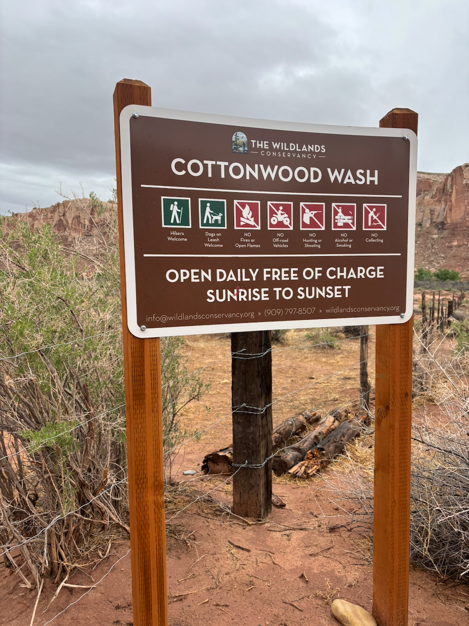
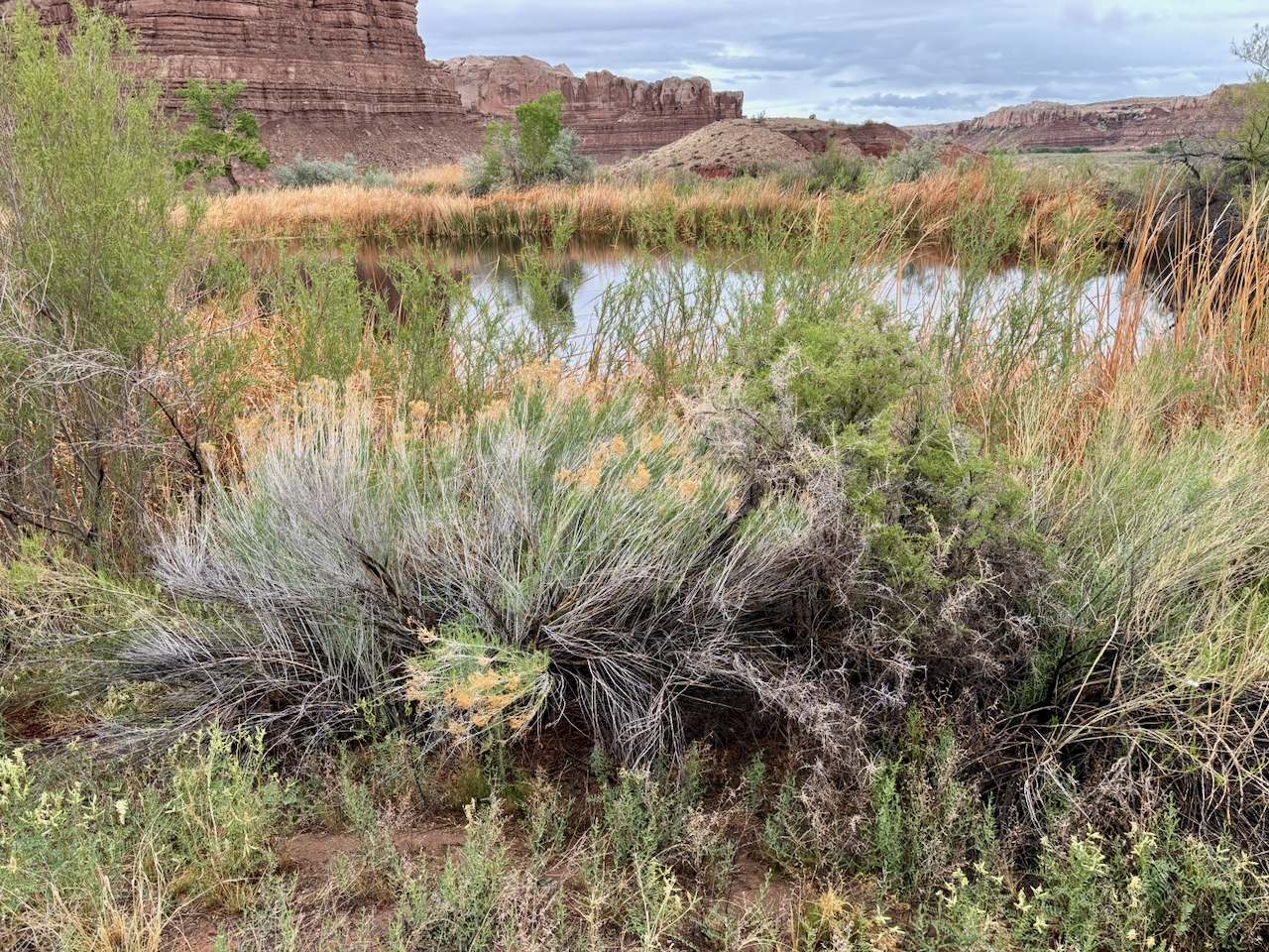
Rain threatened again this day, so once again I wanted to avoid committing to any really long hikes, especially ones through a narrow canyon. Flash floods are no joke. I had read that recently a non-profit organization bought some of the land at the mouth of Cottonwood Canyon near Bluff, so that it would remain undeveloped and accessible for hiking. (in case you don’t know, places like this have a habit of getting bought by rich people from out-of-state who then fence of their private property, blocking the only way in and out of a place)
I was surprised to find a little pond in Cottonwood Canyon. Where does this water come from? Where does it go? I couldn’t figure out the answer to either question, but there are thick shrubs around the water which the birds love.
Later, I drove up Comb Wash to a place that I’ve wanted to see ever since a YouTuber I follow did a video about the area. These rocks are now fenced off, but they have some cool petroglyphs on them. More important, they mark the location of a path that comes down the nearby cliff via hand and foot holds carved into the sandstone.
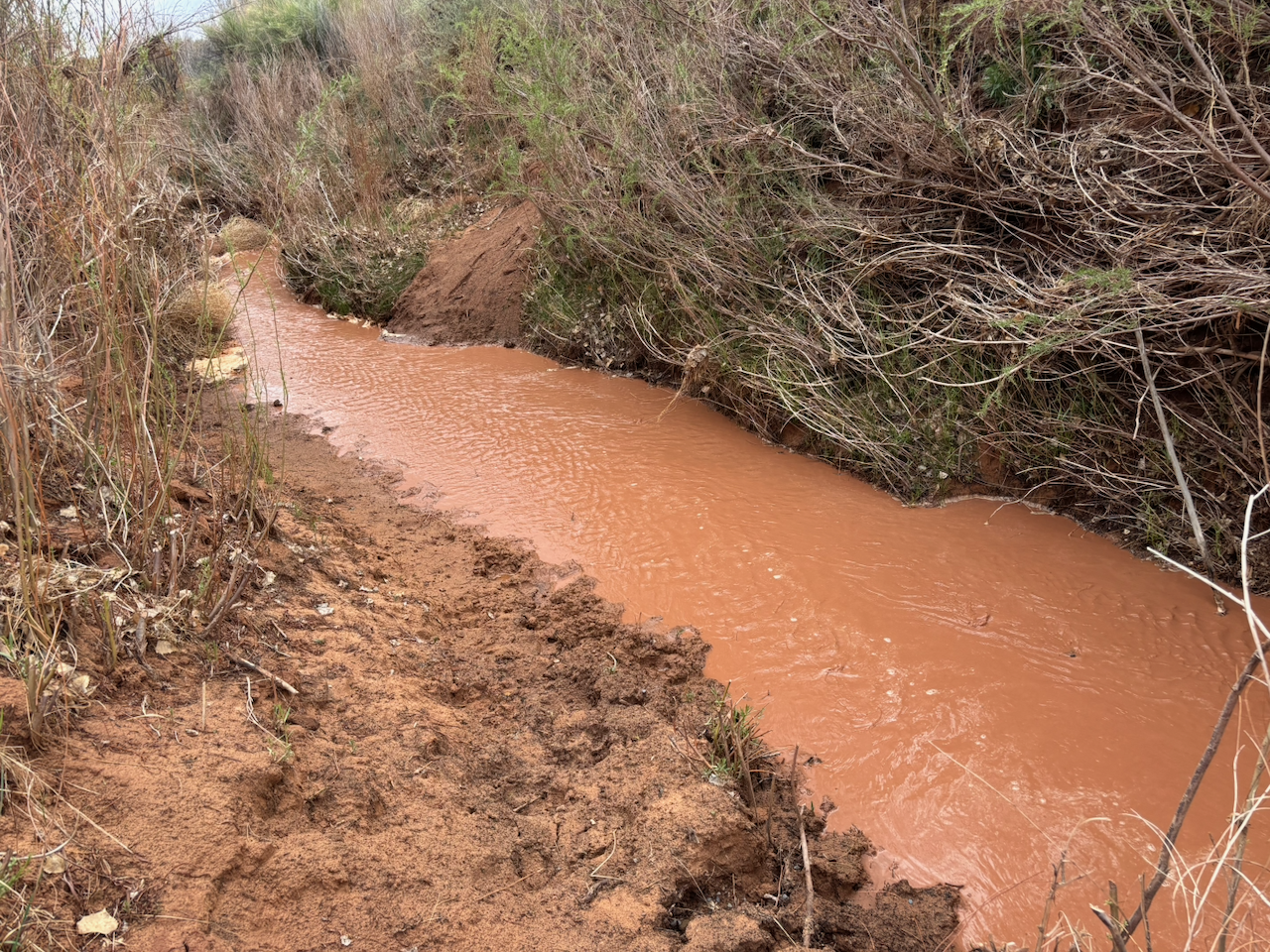
I was hoping to hike the first couple miles into Fish Canyon, but this is what Comb Wash looked like at the time. It’s not that deep, but I was all by myself and know from experience that sometimes when you slide into one of these muddy streams it’s really hard to get out because both sides are incredibly slick. Maybe the muddy water was only six inches deep, but maybe it was waist high. And I had no way to tell. But to get to the Fish Creek trail you gotta get over this stream first. So after weighing the options, I turned back.
Hiking to more rock images
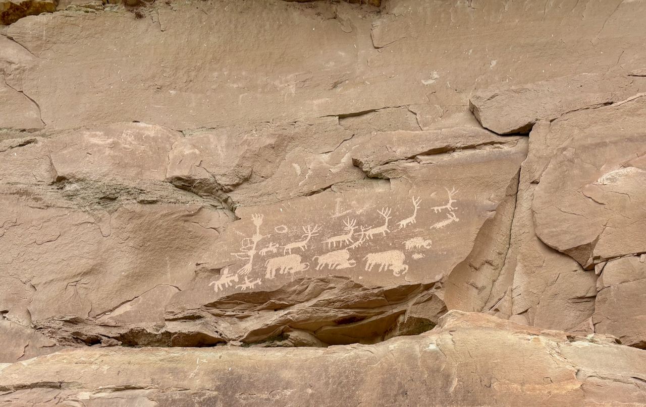
The next day I hiked up one of the many canyons that are carved into the east side of Comb Ridge. Here are some very old petroglyphs I saw. You can tell they’re very old because the carved parts - the lines of the images - are almost the same color as everything else. If they were new, they’d be much lighter in color, and they darken over time.
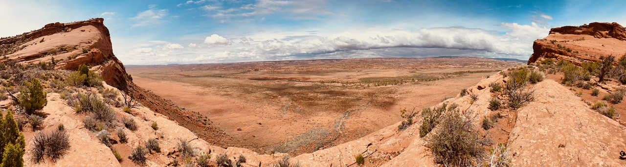
Once I got to the highest part of my hike, I could look down on where I was yesterday. I took this panorama photo showing Cedar Mesa in a 180 degree arc between two of the “teeth” that give Comb Ridge its name. If you look carefully down and to the left in the photo, you’ll see the standing stones with the petroglyphs that I took the photo of above.
More hiking to more rock images
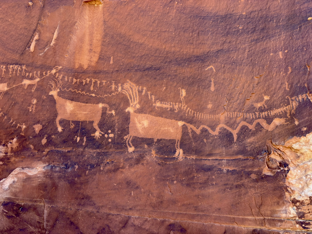
The next day I hiked up a different side canyon of Comb Ridge. This one is much more popular because there’s a famous petroglyph panel there. So I finally got to interact with some hikers, which is one of the main points of my volunteer “job”.
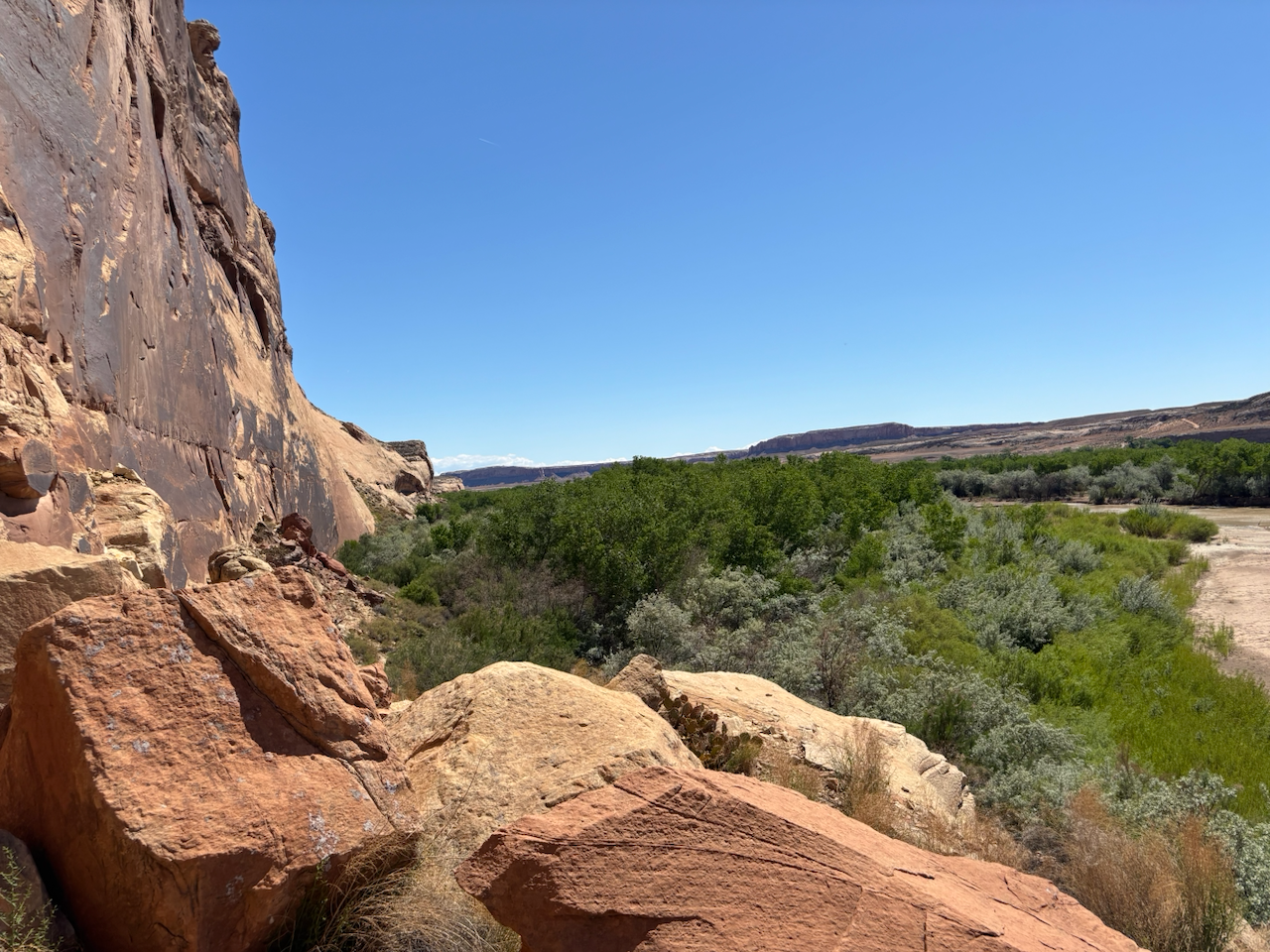
To the river
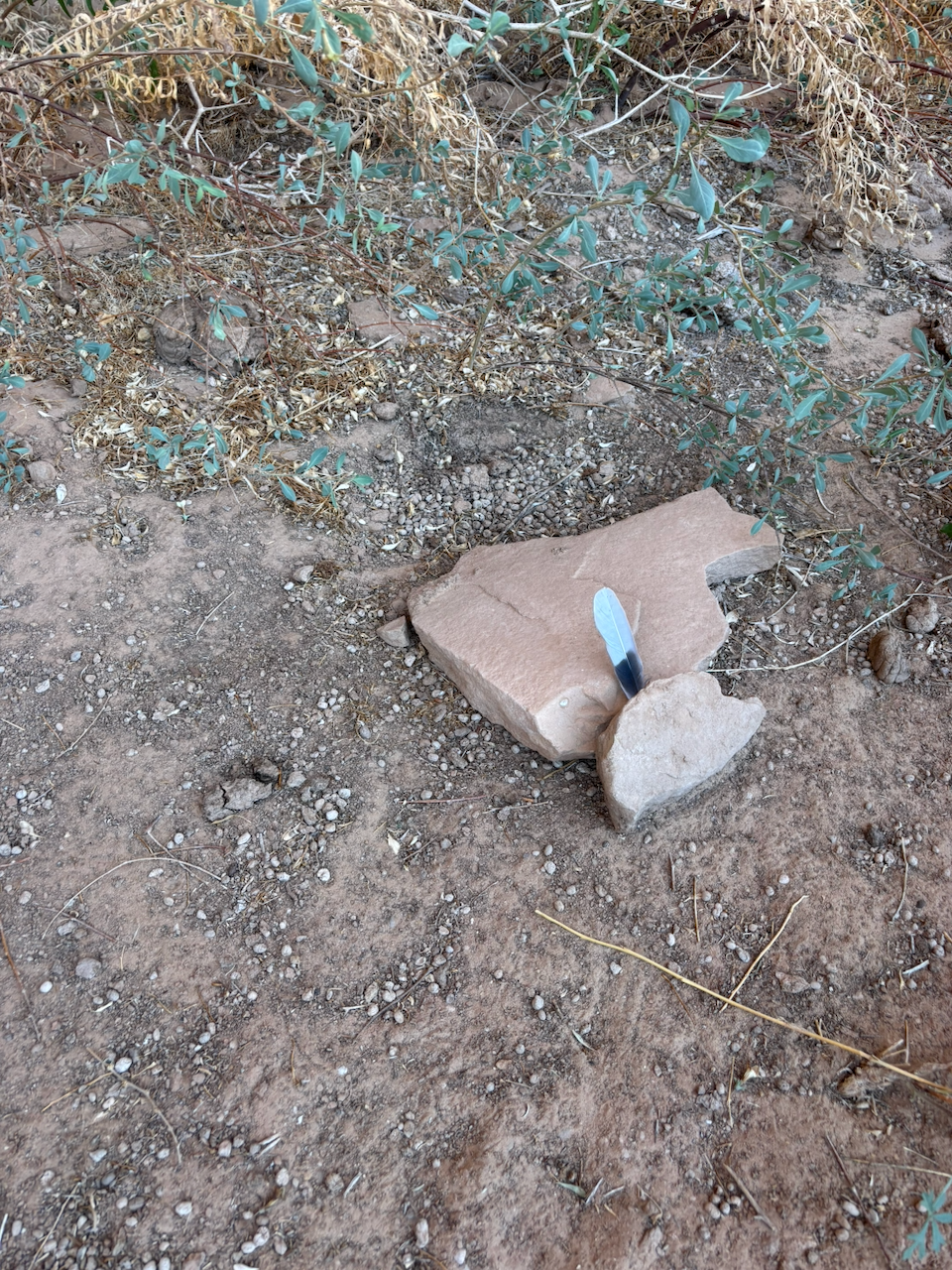
The next day, I hiked down to the San Juan River. I was the only person there that day. There’s a huge petroglyph panel on this cliff overlooking the river. But on the hike down there, I saw this, which was very strange. It was a feather that someone had wedged upright between two rocks. The rocks hold the feather in place vertically. I have no idea if this means something or is just meant to be artistic or maybe even just totally random. But of course I left it alone except for taking a photo and moving on.
Once I got to the river, it was beautiful. And I’m not the only vertebrate who thought so. I heard a bird call I didn’t recognize. It sounded like it was coming from high up the cliff with the petroglyphs on it. But I remembered I have an app on my phone that can identify birds from just their calls. So I recorded a bit of it, and the app told me it was a peregrine falcon! Awesome! I didn’t see her, but I bet it was a female nested high up on the cliff, and she was telling me “stay away from my nest, of else”. I obeyed. Besides, what am I going to do, climb a 300 foot sheer cliff to steal her eggs?
OK, here is one of the highlights of the trip from a petroglyph perspective. I’ll write a whole post about this sometime, but for now I’ll just say that I am enamored with petroglyphs of duck head people. They’re a symbol that are in a fair number of petroglyph panels, but only in this area centered on Bears Ears. I don’t think there are duck head people more than 50 miles away from here.
In fact, I had been planning a trip to the Bluff area this spring (of 2026) where the theme of the trip was going to be visiting as many duck head petroglyphs as possible (I have been making a list). But then I hurt my foot and had to cancel it. So maybe I’ll go in the fall.
Anyhow, these particular petroglyphs are “anthromorphs” (meaning human-like shapes) that instead of having a human head have a duck. I read somewhere that this represents how the katsinas travel…they turn into a duck to fly somewhere, and then turn back. I think that’s the modern Zuni interpretation anyhow; more on that later.
Not far from the duck head people, here was a friendly lizard I saw.
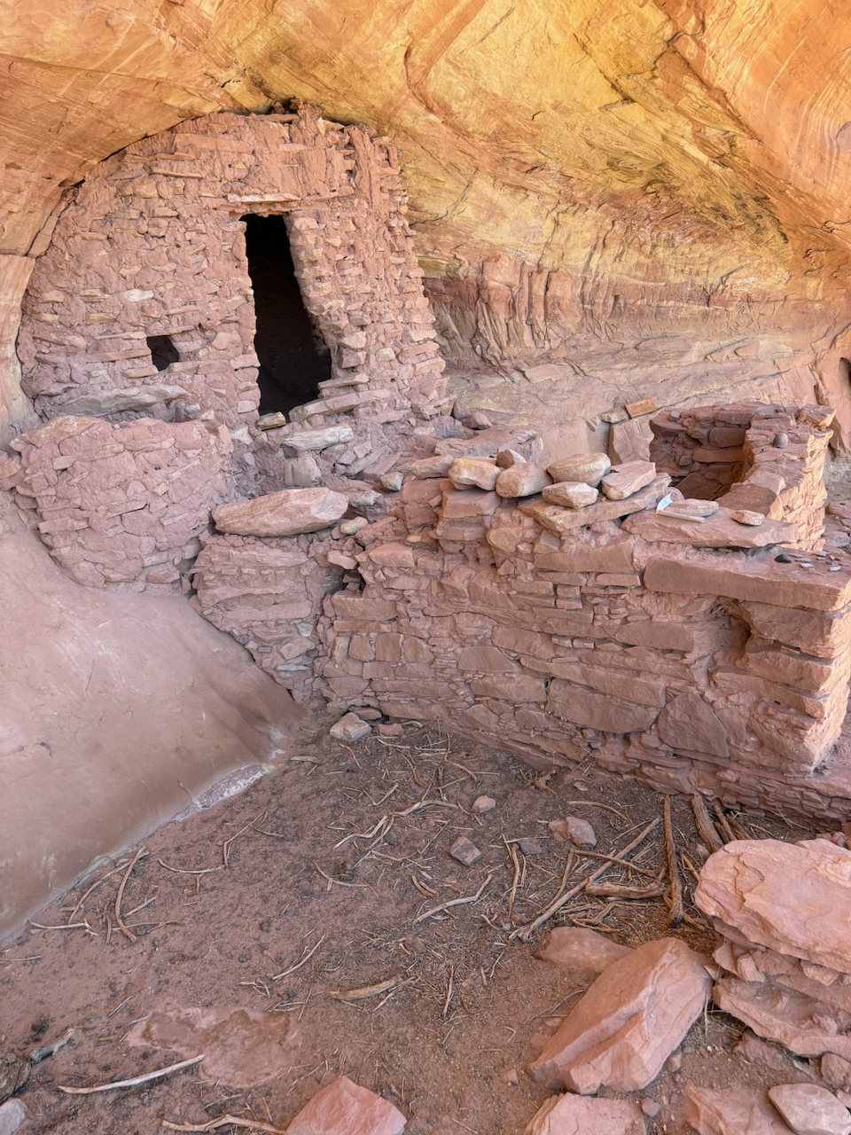
And after hiking back to the car, I decided to do one last short hike for the day. It would be the last of the trip. It’s a little cliff dwelling in the weirdest place, and it’s falling apart in a weird way. I’m not sure why.
The next morning I broke camp and headed back to toward Denver by way of the Paradox Valley and Unaweep Canyon.