October 2001 Vacation
This is a little journal of my trip to Utah in October 2001. The trip was basically split into two parts. First was the original reason I was going to Utah - to attend the annual conference of the Glen Canyon Institute (GCI) in Salt Lake City (SLC). I decided that since I drove all that way, I should take the “scenic route” back and do some camping and hiking, so the second part of the trip was some sightseeing in the southeast part of the state.
The photos were all taken with a 15 year old automatic 35mm camera that I got for Christmas one year. I sent the film to Snapfish.com for developing and got a CDROM of the digitized photos. Some of them came out quite good, despite my poor skill and equipment.
Click on the photos with visible borders. That will show you a larger version of that picture.
[Page [Page
Thursday October 11, 2001
I checked http://maps.yahoo.com and they said it’s 526 miles from my house to downtown Salt Lake City and estimate the drive to be 9 hours. The recommended way to get there is take I-25 north to I-80 (in Wyoming) and then turn west and drive, drive, drive.
The GCI dinner was starting at 6:00 PM on Friday October 12, 2001. Unfortunately, that meant to get there on time I’d have to leave no later than 9:00 AM on Friday, and that still assumed no time spent stopping for gas or food. So I decided I should leave Thursday. But unfortunately I had a meeting in Boulder Thursday night from 6:00 to 8:00. It was the quarterly Board of Directors meeting for the Colorado Bat Society. So I figured my best approach was to leave for Utah immediately after the meeting, drive as far as I could, sleep somewhere in Wyoming, and then drive on the rest of the way Friday morning. So that’s what I did.
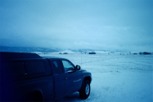
Rather than taking I-25 to I-80, though, I took the cutoff road (US 287) which I’ve heard is actually a bit faster. I didn’t even stop in Laramie but kept driving until it was dark. A snowstorm with extremely high winds had blown in and I pulled off the highway around 10:30 or 11:00, parked in the middle of the Wyoming prairie, and crawled in the back of my truck to sleep. That was a very cold night and the wind shook the truck all night long. Plus, the local coyotes decided to wake me up a couple times with some howling. It sounded like there must have been a whole family a hundred yards or so from where I decided to park.
Friday October 12, 2001
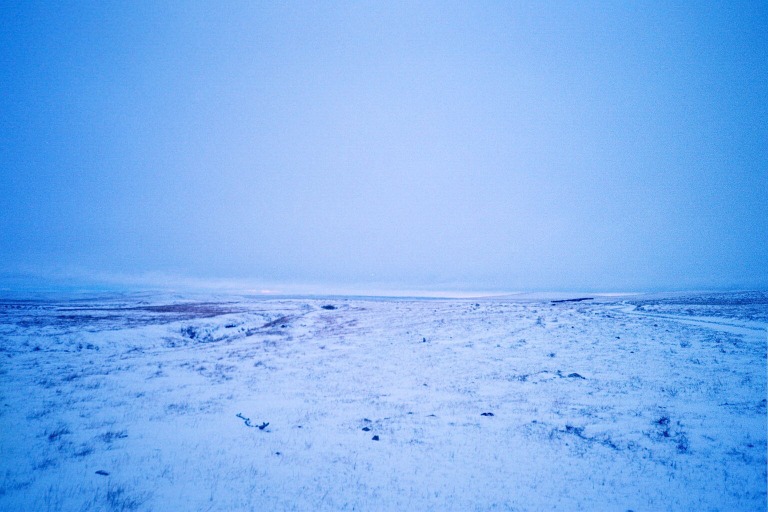
My icy campground
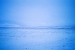
The Snowy Range
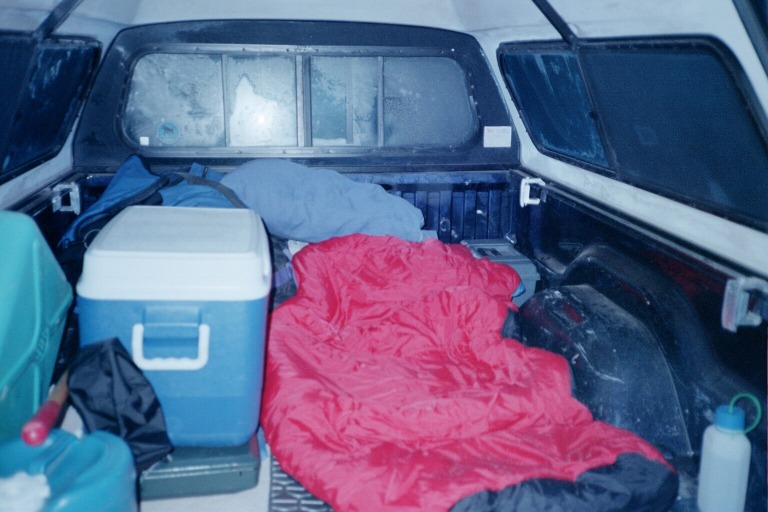
Luxurious accomodations
It turned out that it really didn’t snow that much, but the high winds turned the highway into a seriously slick patch of ice. I woke up around 6:30 or 7:00 and, not wanting to make any kind of breakfast in the wind, continued driving. That morning in the course of just a couple hours, I must have passed at least two dozen semis that had flipped or slid off the road due to the combination of ice and wind. Traffic on I-80 was moving at around 35 MPH in many places, and even that was too fast for conditions at times.
When the sun finally came out mid-morning, the roads got a lot better. By late morning, I arrived at Green River, Wyoming (there’s also a Green River, Utah that I visited later in the trip). There, I stopped at a place called Expedition Island. This is where John Wesley Powell and many other river explorers of the 19th and early 20th century started their journeys. Powell’s two famous expeditions down what we now call the Green and Colorado Rivers both started here. They have a little park on this island now, with plaques commemorating all the explorers and early river rats who started here.
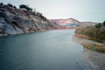
The Green River
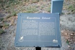
Expedition Island
Plaque about Powell
The memorial park
After walking around the park for some much needed exercise, I grabbed lunch at a local fast food joint and continued on. I didn’t stop again until the Utah visitor center/welcome station, where I got some directions. I had decided that in order to save money, I would stay at Camp VIP. which is the KOA campground in SLC. I’d emailed them before and they said they have a tent area where I could camp for $20 a night. Even though that’s a bit steep for a campsite, it sounded a lot cheaper than a hotel. Plus, it was close to the places I wanted to visit and it had showers.
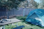 I arrived at Camp VIP around 3:30, set up my tent, and unload the truck. After a little nap and a hot shower, I went to the GCI event.
It started with a silent auction, then we had dinner, and finally a slide show and talk from Katie Lee. There was a lot of stuff I wish I could have bid on there, but I didn’t have much money and was unemployed at the time, so all I bought was a book.
I met many nice people there, including some fairly famous ones. I met famed author and activist Dave Foreman, who was giving the keynote speech the following night. I met Ken Sleight, Edward Abbey’s inspiration for the character Seldom Seen Smith in his famous book Monkey Wrench Gang. He said he recognized me because I always show up at these events. I felt bad explaining that we’d never met. I still don’t know if he was just being extra nice or if he’s getting a little senile, but he’s definitely friendly. I also met author/actress/singer/songwriter/activist Katie Lee who gave an excellent presentation and signed a copy of All My Rivers Are Gone that I bought. The event was a lot smaller than I expected and so I got a chance to meet about half the people there.
That night, I had a little accident in my tent. It was dark and I was reading with the lantern on. We have a Coleman propane lantern that we’ve always hung on a ring connected to the ceiling of the tent. Well, even though Beth and I have done this same thing dozens of times, the little ring decided to melt through from the heat of the lantern (even though I had it turned down pretty low). The lantern suddenly fell down on me and rolled onto my sleeping bag, instantly melting the outer fabric of the bag. Luckily, nothing actually caught fire, but I got a hole in my bag after having used it for only one night! What bad luck. Well, being well prepared, I, of course, had duct tape with me to patch the hole. 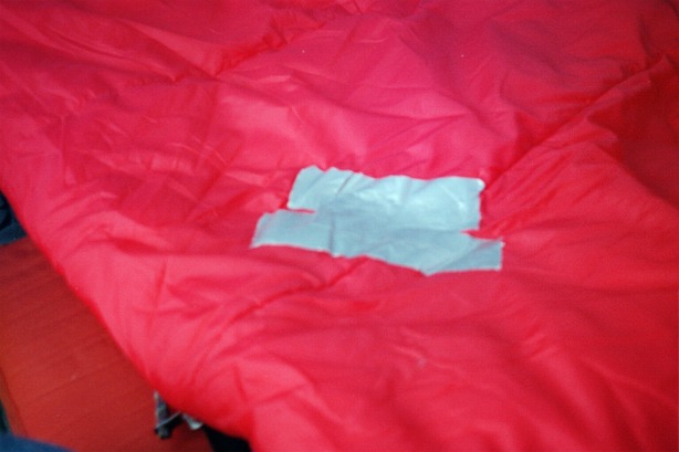
Page 2 [Page
Saturday October 13, 2001
I slept in Saturday morning but the discussion panels they had set up for the GCI conference were starting - I thought - at 9:00. So when I got up and got dressed, I immediately drove off to find the University of Utah campus where the events were being held. I assumed that there must be a bunch of restaurants around campus to serve the student population and that I’d get some breakfast there. No such luck. I found the student union, but the cafeteria was closed on Saturdays and the little snack bar didn’t open until 11:00. So I got some milk from a vending machine and found a computer to log in and check my email.
There were four different panel discussions that day and I listened to all of them. The panelists were a wide variety of people, though I can’t really say that all sides of the issues were equally represented. There was one man from the Navajo Nation who’s in charge of their water interests. There was a woman from Boulder who works for some organization trying to restore fish in the Colorado River delta (which has been dried up since no water flows there anymore in most years). There were a few people from the Glen Canyon Institute. There was a guy from the Bureau of Reclamation (the government organization that operates the Glen Canyon Dam and all others in the basin). There was a guy from the agency that acquires water and sells it to San Diego and other California cities. There was a guy from the power administration that oversees hydroelectric generation in Utah. And some others I’m sure I forgot. Anyhow, the panel discussions were moderately interesting, although inconsistently moderated. Each panel had a different moderator with a different idea of how to…well, moderate. And some of them sucked.
The panels went into the afternoon, at which time I went back to “camp” and had a nap. That night, I discovered that near the campground is a Weinerschnitzel! Yes, they still exist in SLC. So, I had a couple chili cheese dogs before going back to campus for the keynote speech. The keynote was great. Dave Foreman’s talk was all about wilderness and he mixed lots of facts about species preservation with some good photos. It was pretty obvious he gives this talk regularly because it was very polished. Either that or he sure practiced a lot!
Sunday October 14
I somehow lived through another night at Camp VIP. It’s definitely not the best place for tent camping and I probably got less sleep while staying there than I did in the howling Wyoming snowstorm. You see, Camp VIP is situated only about half a mile from the rail yard. And, since Salt Lake City is such a transportation hub, trains roll in and out all night long. And for whatever reason, when they’re in town they blow their whistles almost constantly. I assume it has something to do with dropping off rail cars and picking new ones up. So, every two hours or so, all through the night, I’d get awakened by locomotive horns sounding every 20 seconds or so for 30 minutes. I suppose if you’re in a motor home (as most of the guests at Camp VIP were) the walls might muffle out the sound. But in a tent, it’s like your standing right there at the rail yard. And to make matters worse, they designed Camp VIP such that the tent section is on the outer perimeter of the whole place, right next to a major city street. So my tent was about 10 feet from car traffic right on the other side of a chain link fence. All in all, it wasn’t a good place for a restful night. If I ever get back to SLC, I’ll either stay in a hotel or camp outside the city somewhere.
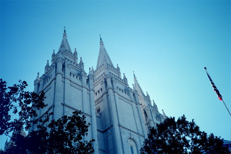
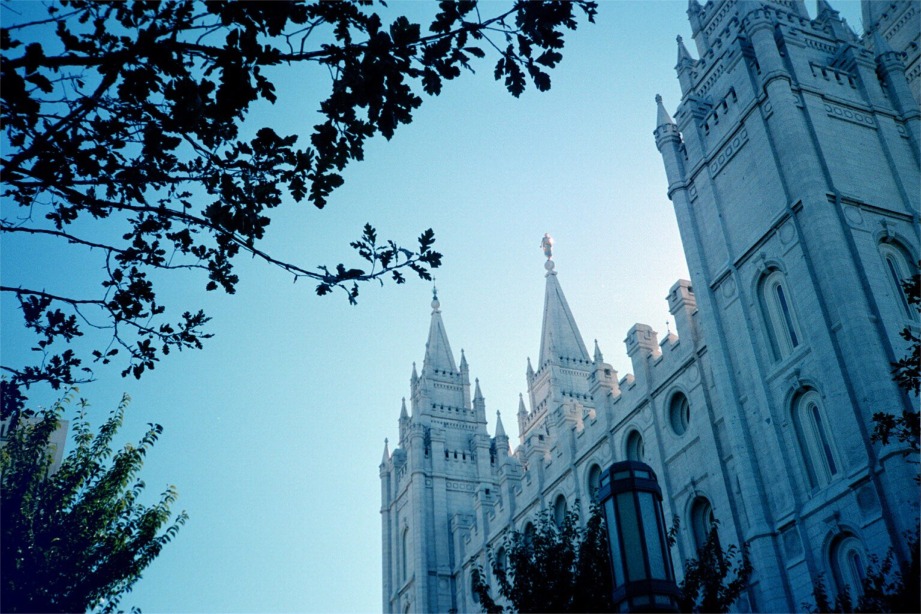
I set Sunday aside for sightseeing. I drove downtown to what’s called Temple Square. That’s essentially the Mecca for Mormons. It’s where they built their main temple, church headquarters, and so on. And, not surprisingly, it’s the center of town. You know that the Church of Jesus Christ of Latter Day Saints is a big business when you see their business offices and conference center. Yes, even though it’s a church, they have a business office which is probably the biggest skyscraper in SLC. And they have a conference center just for the church that must be as big as any big city public convention center. It’s huge! It’s very clear this church has gobs of money and they’re not afraid to spend it on material possessions, fine artwork, and monumental edifices.
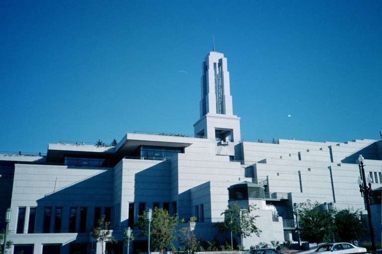
The Conference Center
Seagull statue

A smaller temple
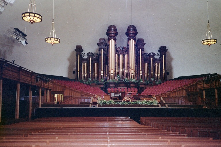
Mormon Tabernacle
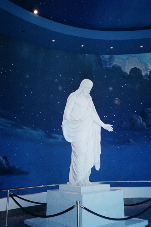
The Jesus rotunda
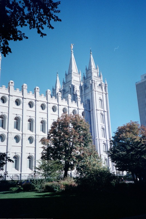
The big temple
I hooked up with a free tour of the area, given by a pair of missionaries whose names I can’t remember. One was from Utah and the other was from South America somewhere. Unfortunately, the tour was pretty light on historical and architectural details. They spent about half the time talking about religion. But it was nice to see everything. We saw the temple - from the outside, of course, since the general public isn’t allowed to go into any LDS temple. We went inside the famed Mormon Tabernacle. One interesting factoid I learned is that the pews are all made of pine that has been meticulously painted to look like oak. They painted fake wood grain on it and everything!
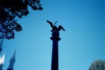
There’s a statue commemorating how seagulls saved the early pioneers from a plague of grasshoppers. Or was it crickets? Anyhow, the bugs were eating the crops and then, after much praying, seagulls flew in and ate all the bugs. So, that’s why the seagull is the state bird of Utah.
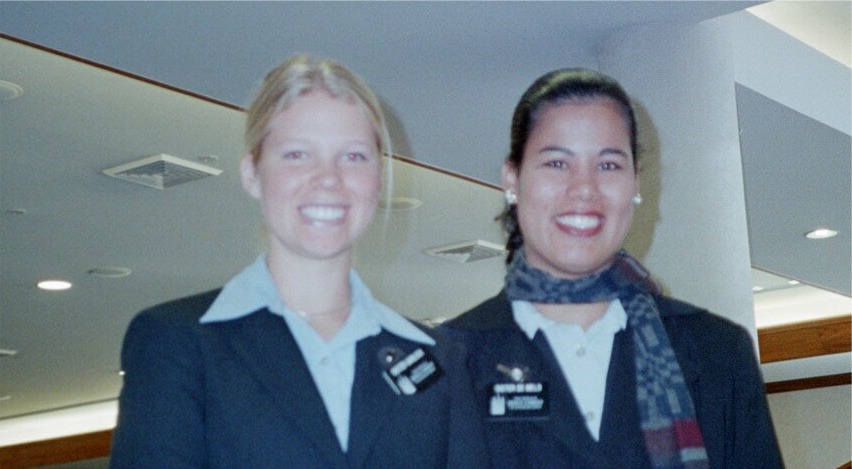
The tour guides
The big temple
More big temple
After the tour, I tried to find a shopping mall in which to pass the time. Unfortunately, my options were pretty limited, since it was Sunday. There are two malls downtown. But one is totally closed on Sundays and the other didn’t open until noon and sucks anyhow. So, I went on a search for a sporting goods store, because I wanted to buy a new day pack with a built in hydration system. I drove to another mall, which didn’t have anything. Then I guessed (correctly) that SLC probably has an REI. So, I got the address and, after getting lost once and driving to the wrong side of town, finally found the REI store and went on a shopping spree.
[Page
Monday October 15
By this time I was anxious to get out of town. Unfortunately, when I got up (before dark, since the sun rises so late in SLC in mid-October) my tent was all wet from dew. And I didn’t want to pack it up wet since I knew that was the last I’d be using it this year. I planned to just sleep in the back of the truck for the rest of the trip. So I went out for a hot breakfast to let it dry out some. By the time I was done, the sun was coming up and I packed everything up and started driving south.
Eventually, I left the mountains and knew I was getting closer to Green River (which is in the desert), where I planned to stop for lunch. I had a fine meal at the gas station Burger King in Green River, then stopped at a roadside fruit stand for a locally grown canteloupe, then went to the John Wesley Powell Museum. I’d never been there before. It’s basically a museum dedicated to Powell and other early river explorers. I watched their slide show and checked out all the exhibits, then bought some maps and books in the gift shop. Then I drove south.
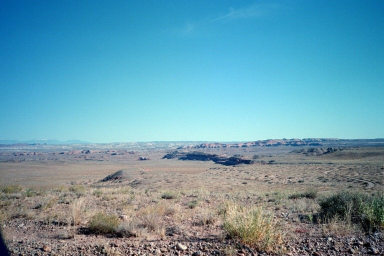
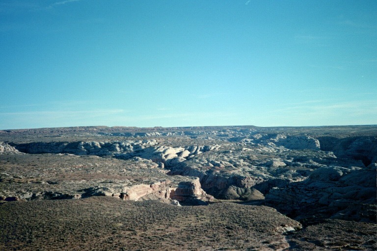
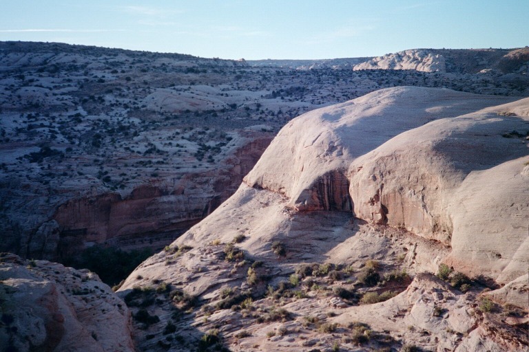
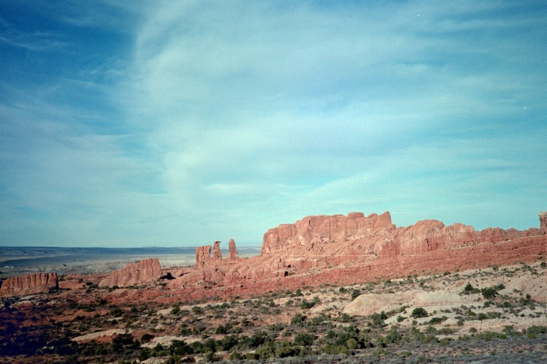
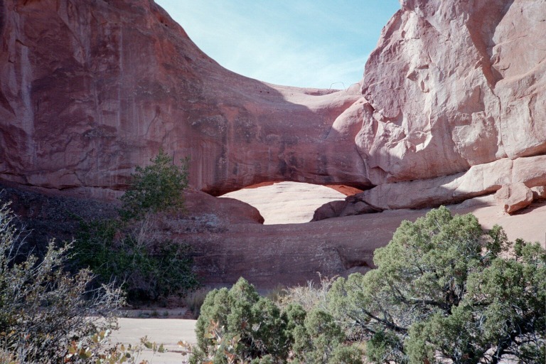
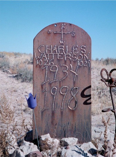 My destination that day was Horseshoe Canyon. That’s a part of Canyonlands National Park, and the only part of the park I’d never visited. Most people get there by way of the paved state highway that goes to Hanksville, but I wanted to see some new scenery, so I took some county roads instead. I didn’t see one other car on the drive down there, but did stop to look at this unusual grave marker by the side of the road.
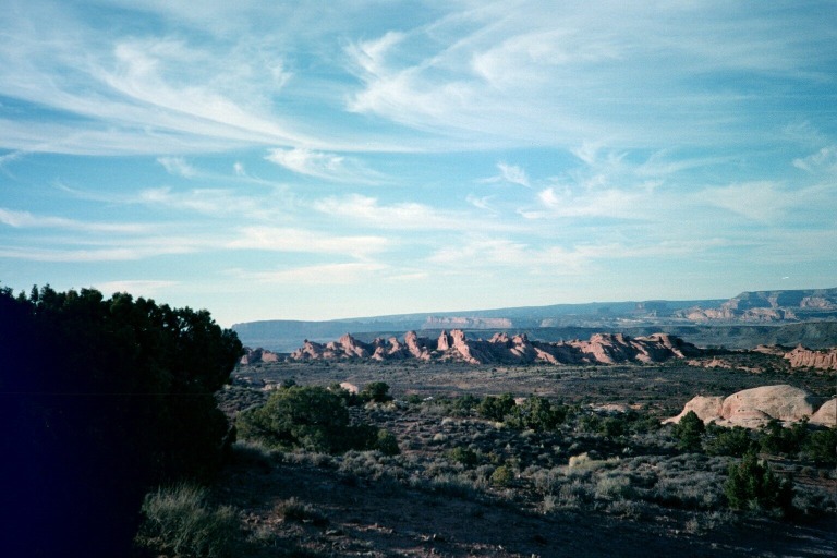
I got to the campground in late afternoon, but had a couple hours left before dark so I went for a little hike to try out my new day pack and to find a rock to sit on and do some reading.
San Rafael Desert
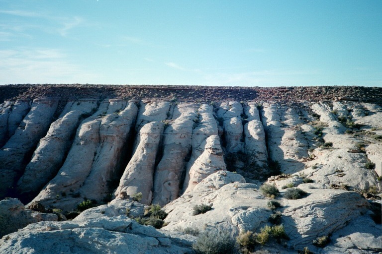
Sandstone
Horseshoe Canyon
Horseshoe Canyon
When I got back to my truck, I made some supper. I think the smell of whatever I was cooking must have carried, because I was soon visited by a coyote puppy. It came right up to me like a domestic dog might, wanting some handouts. At first it startled me, but once I realized what it was I tried to scare it off. It would jump back for a few seconds and come right back up to me. So I decided to take a few photos of it.
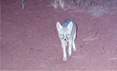
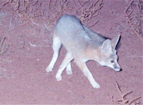
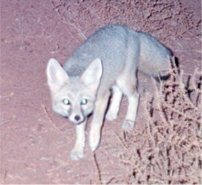
What a cheeky little guy! Eventually, once he realized he was getting no handouts, he wandered off.
(When my dad saw these photos, he thought this was a fox. Normally, he knows more about wildlife than I do, but I still think it’s a young coyote.)
[Page [Page
Tuesday October 16
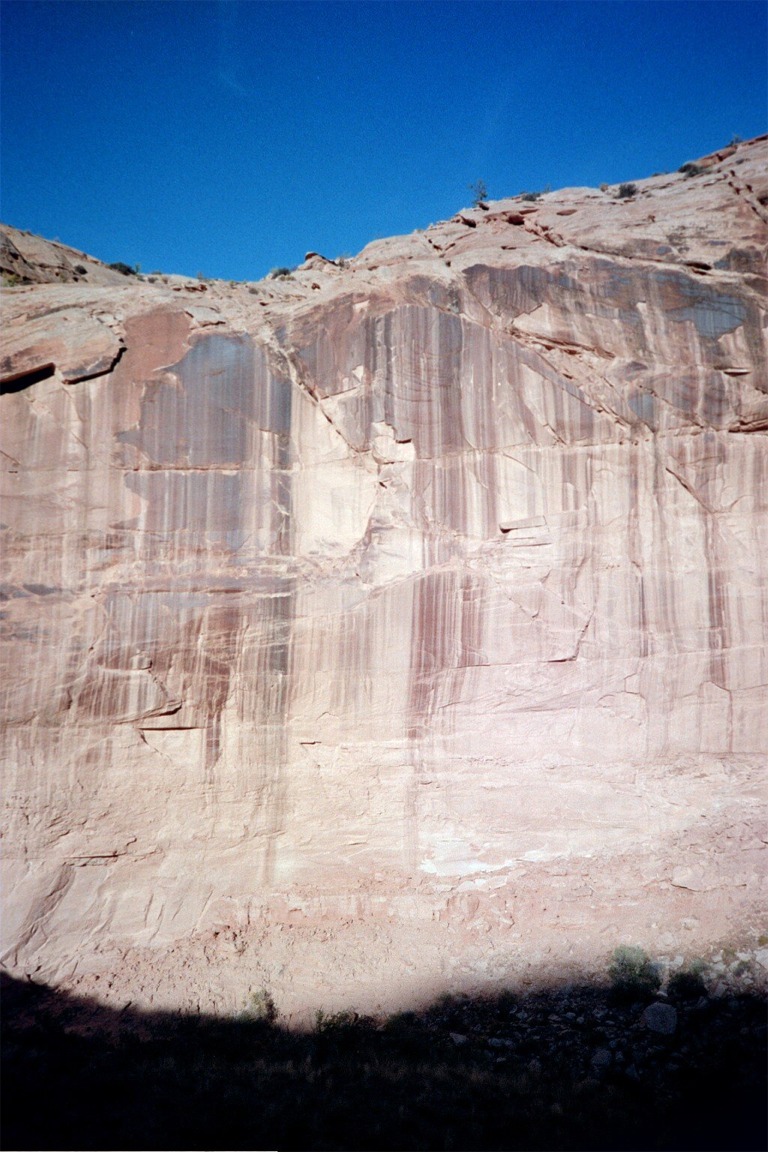
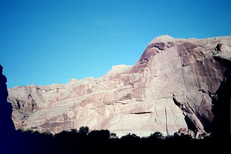
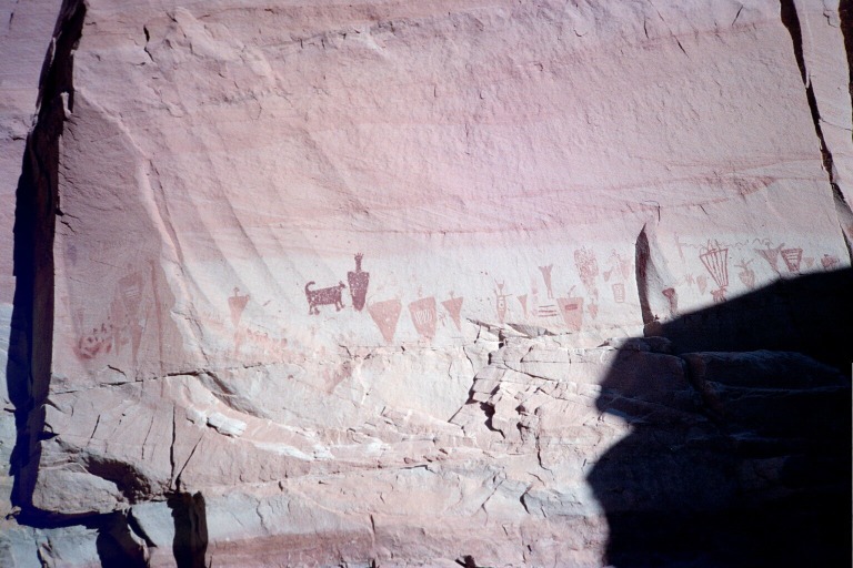
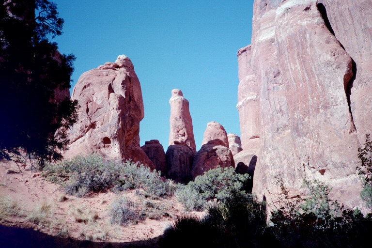
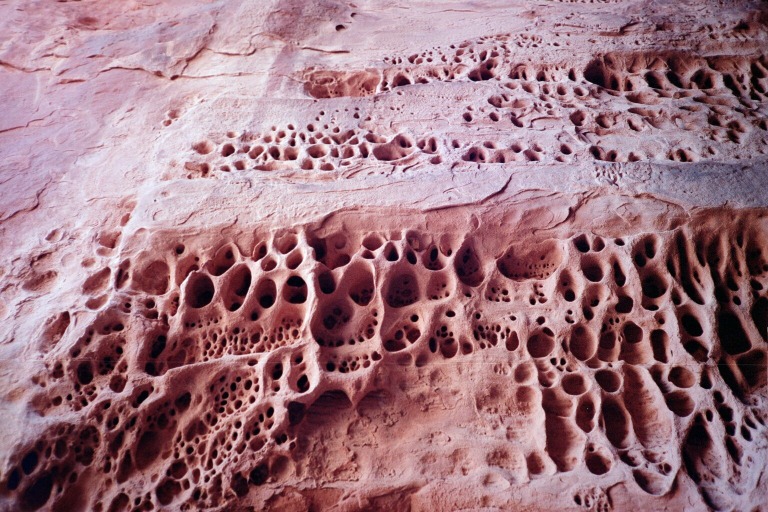
 Horseshoe Canyon is famous for one and only one reason. It’s the location of some very famous archaic rock art. There’s a certain style of rock art found in the Utah/Colorado area that’s called Barrier Canyon Style. I’d seen this term before in books, and didn’t think much about it. But then I learned that “Barrier Canyon” is what’s called Horseshoe Canyon nowadays. I don’t know why or when they changed the name of the canyon from Barrier to Horseshoe, but this is the place that gave the whole style of rock art its name.
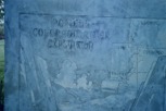
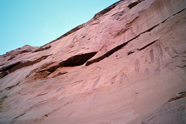
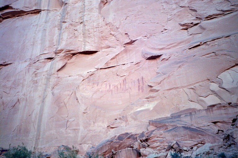
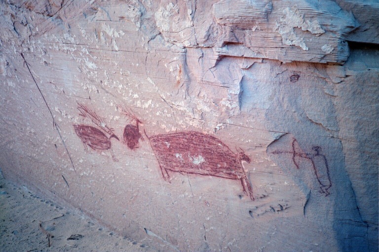
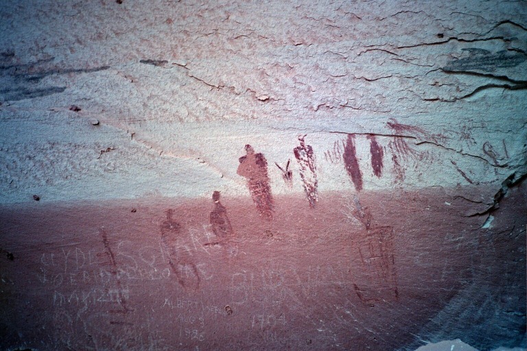
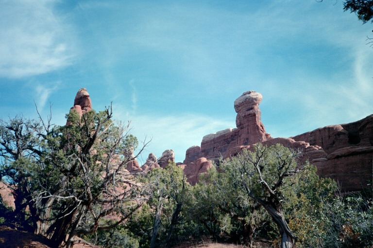
The hike into Horseshoe Canyon follows an old jeep trail from the canyon rim down into the bottom, and then follows the dry creek bed for a few miles. On both sides of the creek are four rock art panels. They say these all date to around 2000 years ago, though they’re not really sure exactly. It’s not often you get to see artwork dating back 2000 years, and so these panels are pretty rare and precious. Nonetheless, visitors regularly feel the need to vandalize them. I don’t know why someone would bother to drive way out into the desert and then hike into this hot, dry canyon to see the rock art, and then scratch over it with their own names.
Anyhow, I was the first person into the canyon that morning, since I require so much less to get going in the morning than most people. The other people camping there were just starting to get up, make coffee, and break down their tents when I rolled out of the back of the truck, stuffed a couple breakfast bars in my pocket, and set out hiking. It’s a nice hike. Scenic rocks and good art, of course.
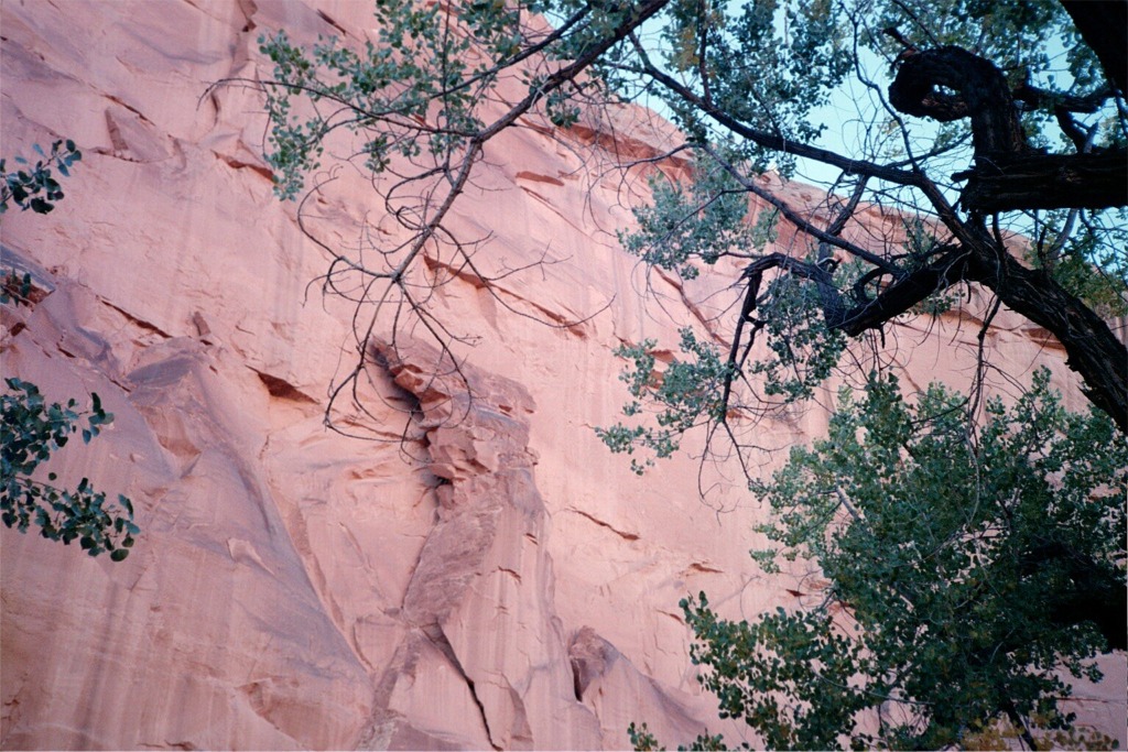
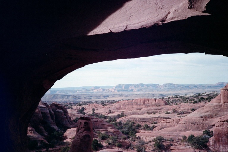
The biggest and most famous panel - The Great Gallery - is the last one on the hike. I got there about lunch time, checked out all the paintings, and had lunch under a shady tree. The park service has a pair of binoculars there to help you see the rock art, but I didn’t see why they were necessary. They also have copies of a lot of scientific articles regarding Barrier Canyon Style artwork. Those were interesting to me.
Desert varnish
The high res version of this photo looks awesome - click to see medium res
Sandstone
High Gallery
Bow-and-arrow dude

Self-portrait
Massive vandalism
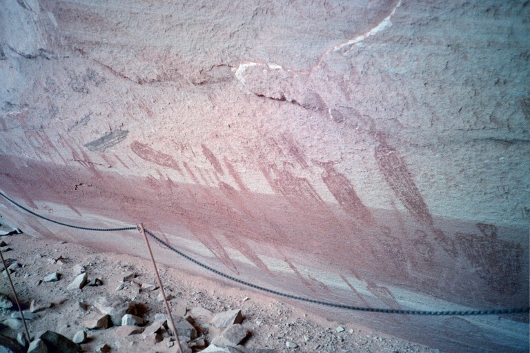
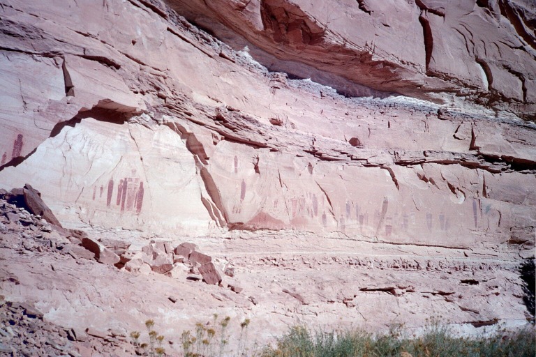
The Great Gallery
The Holy Ghost
See the big version
Look for animals inside
Round trip, the hike is around 7 miles with only the first section (descending into the canyon) presenting any kind of challenge and even that’s not bad. Walking several miles in a sandy creek bed is more tiring than it sounds, though. I hate walking in sand.
Self portrait in front of the road to the bottom of the canyon
It’s all down there, somewhere
I climbed back out of the canyon in mid-afternoon, had a delicious cold beverage, and drove away. I went west to highway 24 and took the highway back to I-70. I stopped at the rest stop right before Crescent Junction and…well, rested. I also found I had cell phone coverage, so I phoned home to get the latest scoop on a job offer from Voyant Technologies. I called my soon-to-be-boss on the cell phone and told him I accepted his offer and would be there Monday morning. Then I drove on to Arches National Park.
I stopped at the visitor center, paid my admission fee, and paid in advance for a ranger guided hike in the Fiery Furnace for the following day. Then I drove into Moab where I treated myself to a steak dinner at the Slickrock Cafe. Their food is decent, I guess, but they also have public internet access. So I caught up on my email and found a message from one of the people from the Living Rivers Project/Glen Canyon Action Network, whom I’d met a few days earlier at the Glen Canyon Institute conference. Ironically, he wrote something like, “If you’re ever in Moab, give me a call.” So, I was glad I checked my email and I called him. Unfortunately, he was busy in a meeting to plan some upcoming activism. I passed the time reading my book and visiting Tom Till’s art gallery down the street. The Glen Canyon Action Network has a very interesting approach to fund raising. They operate an ice cream store right on the main strip in Moab. It’s called Restoration Creamery, and all the profits of their ice cream business go to help fund their activism and education efforts. Finally, we hooked up and they told me about everything their organization is doing. It was clear that they hadn’t gotten up early and hiked several miles across hot sand that day, because they just kept talking and talking and talking until about 10:30, when I finally convinced them I was too tired to listen anymore.
I drove back to Arches, up the main road, and out the Salt Creek dirt road to the place where it exits the park. Since the area surrounding the park is BLM land, you can camp anywhere you want. Contrast that to the land on the other side of the fence, where you can only camp in the one campground and it’s always full. So as soon as I went through the gate, I pulled off the road and crawled in the back of the truck to go to bed.
[Page Page 5
Wednesday October 17
I’ve visited Arches several times over the past 18 years, but there was one road I’d never taken - the 4WD road. It leads back into an area that is, as you can imagine, much less traveled. And because there’s one section of very deep sand on the side of a hill, they recommend going from north to south, which was perfect for me because I was camped out the north side of the park.
So, the agenda that morning was to drive the 4WD road and stop and see the arches back in this area that I’d never seen before. My Fiery Furnace hike started at 2:00 PM, so I didn’t have all day, but I figured I’d have enough time. The road was quite a bit worse than I expected and in spots was downright rough, so it was slow going. But I did get out and take a couple of hikes that morning.
The first hike was to Tower Arch. Although I can’t remember for sure, I think I’ve been to this arch before. There are two ways to get to it. You can take the 2WD drive that splits off the Salt Creek road, and then hike a mile or two. Or you can take a side spur of the 4WD road and just hike a half mile or so. I think we tried to do the former when I was a teenager, but I can’t remember if we completed the hike or not. This time I took the latter. It was a nice little hike and a nice arch. I didn’t see anybody else until I was on my way out. I was hoping to see some desert bighorn sheep on this hike, since I read they’ve been spotted back here before, but I didn’t.
Near Tower Arch
Beautiful fins
The Tower
Tower Arch
Eye of the Whale from the front
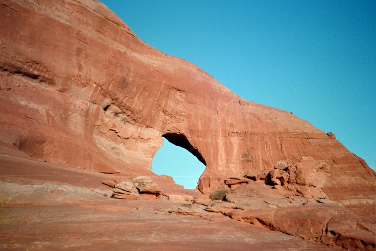
Then I drove on through alternating sections of rock and sand until I got to Eye of the Whale Arch. This is one I definitely had never seen before. I took a short walk up to the arch and had lunch in the shade. Even though it was mid-October, the weather was unseasonably warm for my whole trip.
Eye of the Whale from the back
I eventually made my way to the Fiery Furnace, with a few minutes to spare. Then we went on a 2.5 hour hike through this area.
My tour group
Inside the furnace
Skull Arch
Ranger Alicia
The tripe rock
What a surprise!
From the parking lot
Cryptobiotic organisms
Looking Glass Rock
After the hike, I drove out of Arches and headed south. I stopped at Looking Glass Rock, which is on BLM land and which I’d never seen before. It’s an arch only a mile or two off the main road, near La Sal Junction. Since I was losing daylight fast, I immediately took a quick hike up the rock to the arch. Since it’s BLM land, the camping area is right at the base of the rock - something the Park Service wouldn’t do nowadays. After I got back, I heated some canned spaghetti and crawled into bed. Boy did I regret eating that whole can of spaghetti! My stomach hurt all night.
[Page [Page
Thursday October 18
The next morning, I got up and set out driving toward Colorado. There’s a road that goes east from La Sal Junction to just south of Grand Junction. Again, even though I’ve been all around this area, I’d never actually driven through it and that was one of my goals of this trip. I didn’t have any breakfast, thinking I could get something to eat in some little town somewhere on the way.
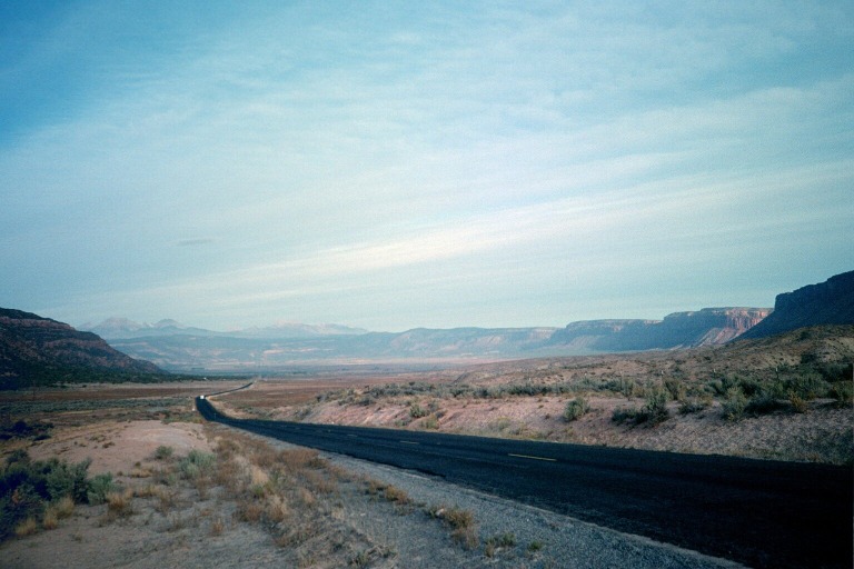
Paradox Valley with La Sal Mountains in background
The road goes up into a mountainous area where I saw a bunch of deer at sunrise. Then it descends into Paradox Valley, so-named because the river in it actually runs perpendicular to the direction of the valley. The river comes through one of the canyon walls, cuts across the valley, and then goes through the other canyon wall. Very strange.
I stopped in some little town I already forgot the name of and had a hot breakfast. It was one of those places where when you walk in the door, everyone in the cafe turns their heads to look at you. I was wondering if I’d grown horns or something, but then realized it’s just because they’re all locals and the sight of an outsider may have frightened them. That and the fact that they were all wearing long sleeve shirts and jeans and I was wearing shorts and a t-shirt.
After breakfast, I headed down a very pretty valley where all the leaves were at the height of changing colors. Then I passed by the old Uravan tailings ponds, which are proudly visible from the main road. I stopped to read the sign that they had marking this spot. It said something like, “Here is the former site of the Uravan mining town, where they mined uranium and vanadium. The mine shut down, but the mining company has undertaken a monumental cleanup effort which will take another 10 years. By the time it’s finished in 1989, this entire area will be restored to its natural appearance.” I laughed. The area looked nothing like its natural appearance, unless God for some reason created this valley with naturally occurring plastic-lined tailings ponds.
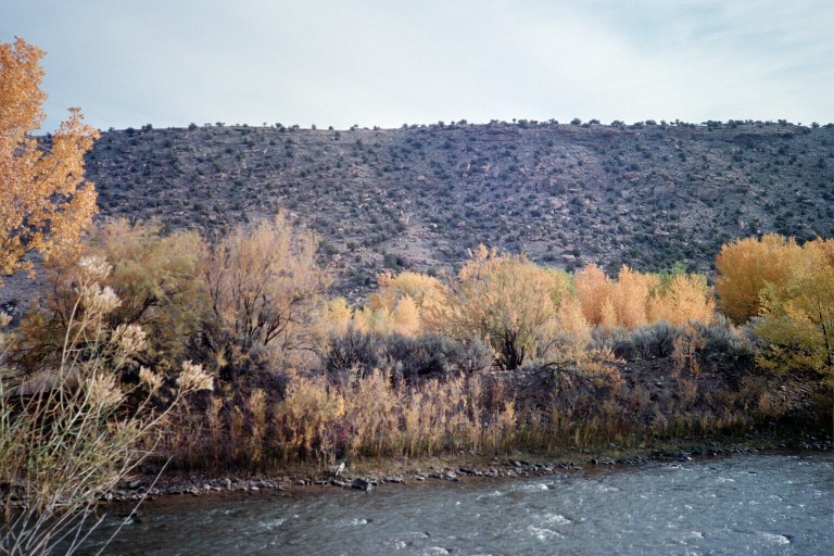
 L: Changing colors along the river
M and R: Hanging Flume - Look closely on the wall of the canyon
Later, I passed Hanging Flume, another reminder of the mining industry. This was a monumental undertaking sometime around 1900. There was a mine that needed water, so they built a flume to divert some water from the river. However, because the river was in this deep canyon, the only place the flume could go was right on the canyon wall. So they built several miles of wooden flume attached right onto the side of this sheer cliff. The mine then went out of business not 10 years later and the flume has been slowly falling apart ever since.
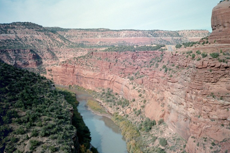
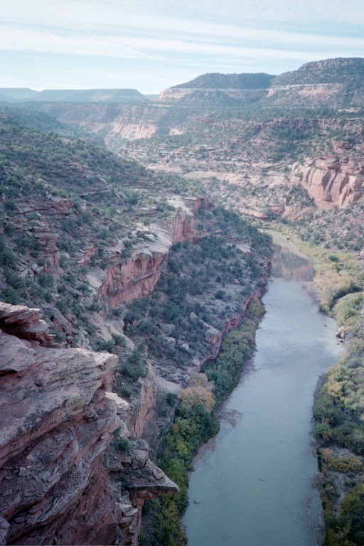
Dolores River canyon (I think)
I drove through the Dolores River valley and then into Unaweep Canyon, passing the Unaweep Seep on the way. Unaweep Seep is this place where water seeps up out of the ground and makes an unusually lush area about a half mile long. There’s a little viewing area for this with some signs. They say that there are some species of animals and plants that aren’t found anywhere in the surrounding area for hundreds of miles except right here in Unaweep Seep. 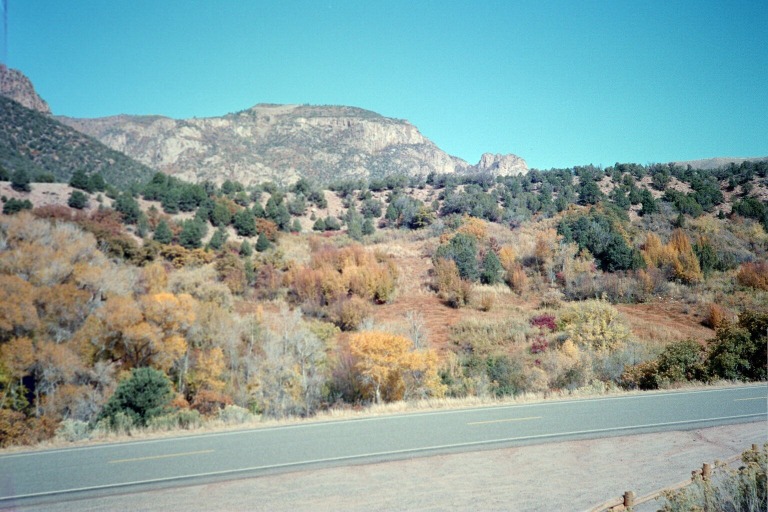
Unaweep Seep
Unaweep Canyon is interesting in that it has two canyon mouths. They say this was the channel for the Gunnison River millions of years ago, until the Uncompaghre Uplift happened. Then, the Gunnison found a new channel. And now water in the Unaweep Canyon flows out both sides, depending on which side of the divide you’re on. I’d heard lots of good things about the scenery in Unaweep Canyon but I wasn’t overly impressed, personally.
Thimble Rock and Driggs Mansion
Down the road a ways are Thimble Rock and the Driggs Mansion. I stopped to photo both of those. Driggs was a rich easterner who built this mansion out in the middle of nowhere. I guess his family didn’t like it or something because they only visited a few times and never moved in and it soon fell into disrepair.
I eventually got onto the highway and drove to Delta, then turned east to Paonia, where I stopped for some fruit syrup and a box of apples. Passing by Paonia Reservoir, I drove up and over McClure Pass and down into the Crystal River valley, where my parent live. Mom was out of town, but Dad was there. I got a shower and did some laundry and then he took me out for dinner in Redstone. We decided to go fishing the next day.
Friday October 19
Dad and his friend getting ready to push off from the bank
Friday morning, we got up and drove down to Glenwood Springs. There we met with a fishing friend of my father. I feel bad I can’t remember the guy’s name now, but he’s got a boat. We got all suited up for fly fishing and set out in his boat on the Colorado River. Dad and I fished all day while the friend mostly just rowed. What a deal! Unfortunately, the fishing wasn’t so hot. Dad didn’t even catch anything, which hardly ever happens anywhere. And I definitely didn’t. But it was a great day and we all had a really good time on the river.
Dad trying (and failing) to catch a fish
During one stop, Dad spotted these footprints in the mud on the river bank. Neither of us knew what they could be. To me, they don’t really look like bear tracks, but I don’t know what else would make impressions like this. So I took a couple photos of them in hopes I could compare them to footprints of other animals later.
Once the boating/fishing trip was done, we changed back into normal clothes and went to a Mexican restaurant in Glenwood Springs. Then I drove home in the dark.
I was happy to get home after being gone over a week, but I had lots of good times on the trip. I saw many places I’d never seen before and even got a new job!
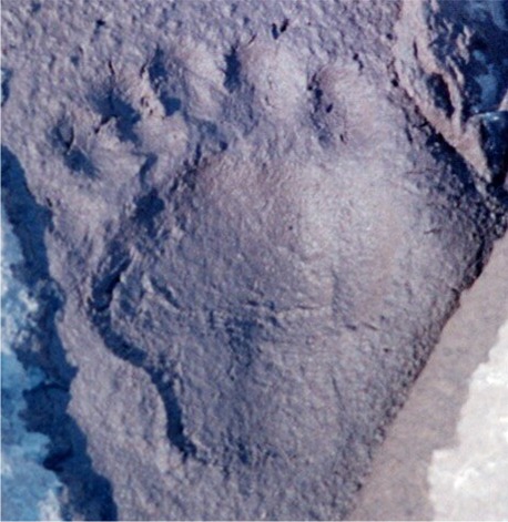
What made these tracks?